Understanding the bay
Boka Kotorska — the Bay of Kotor — is the southernmost fjord in Europe, a drowned river canyon that cuts 30 kilometres inland from the Adriatic. It actually consists of two connected bays: the outer Herceg Novi Bay and the inner Kotor Bay, linked by a narrow passage at Kamenari. The water is deep, calm, and clear. What the bay lacks in long sandy beaches it compensates for with dramatic limestone cliffs, Venetian hilltop towns, and a swimming environment that feels almost enclosed and protected compared to the exposed coast.
Kotor city and its waterfront
Kotor old town is a UNESCO World Heritage site entirely surrounded by medieval walls. Its immediate waterfront is a stone promenade rather than a beach; most swimming near the town happens from concrete and rock platforms along the northern shore of the inner bay, in the Dobrota neighbourhood a kilometre or two north of the old town walls. Several small beach bars operate on terraced platforms here — think aperitivo culture more than full beach-club operations: a glass of local wine, a plate of prosciutto, your feet dangling above the water.
The public swimming platform at Šuranj, about 2 kilometres south of the old town walls on the road towards Tivat, is the easiest free option for visitors staying in Kotor.
Dobrota
Following the bay shore north from Kotor through the ribbon village of Dobrota, you'll find the bay's most civilised swimming. A series of stone jetties, small beaches, and converted boat sheds — some now functioning as restaurant-bars — stud the kilometre after kilometre of shoreline. The restaurants at Dobrota (Konoba Galion and Stari Mlini are the long-established names) are reason enough to come; eating grilled fish with the bay and Vrmac mountain behind it is a Kotor experience that exceeds most of what happens at the beaches.
Perast and Gospa od Škrpjela
Perast is the most beautiful village in the entire bay — a Baroque ensemble of palaces and towers on a narrow coastal strip, with two islands visible offshore. The larger island holds the church of Gospa od Škrpjela (Our Lady of the Rocks); local boat taxis run out there for a few euros. Neither island has a beach as such, but the boat ride gives you a view of the bay that is hard to improve on. Swimming off the rocks near the Perast waterfront is perfectly pleasant; a small beach-bar cluster operates in the village during summer.
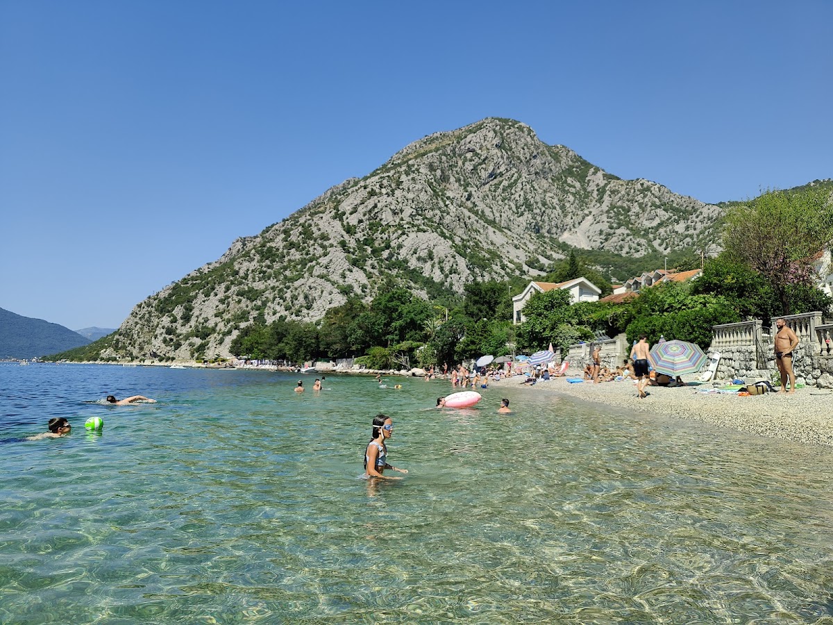
Lepetane, Kamenari, and the northern shore
At Lepetane, a car ferry crosses the narrows to Kamenari — one of Montenegro's most useful shortcuts if you're heading to Herceg Novi. Just north of the ferry terminal, hidden beaches appear as you follow the road toward Risan: small, often empty, accessible by scrambling down from the road. The water here is noticeably calm. These spots are beloved by locals who know them and largely ignored by tourists.
Risan itself, at the bay's deepest point, has a small pebble beach and some of the best-value seafood restaurants on the entire coast.
Stoliv, Prčanj, and the southern shore
The south shore of the inner bay — between Kotor and Tivat — passes through Prčanj and Stoliv, both offering swimming off stone platforms and the occasional small beach. Prčanj's church of the Nativity is visible from across the bay; there's a shaded coastal path here that's excellent for an early-morning walk before the heat sets in. Stoliv has almost no tourist infrastructure, which is precisely its appeal.
Bay vs. open coast: what to expect
Water in the bay is typically 1–2°C warmer than the open Adriatic in early and late season, because the enclosed geography retains heat. There is almost no wave action — excellent for nervous swimmers and small children. The absence of surf also means the water is silkier and more transparent. What you won't find is the energy of Budva or Ulcinj: the bay is for people who choose a quieter, more contemplative version of the Adriatic. Come for the scenery, the food, and the ancient stones reflected in calm water.